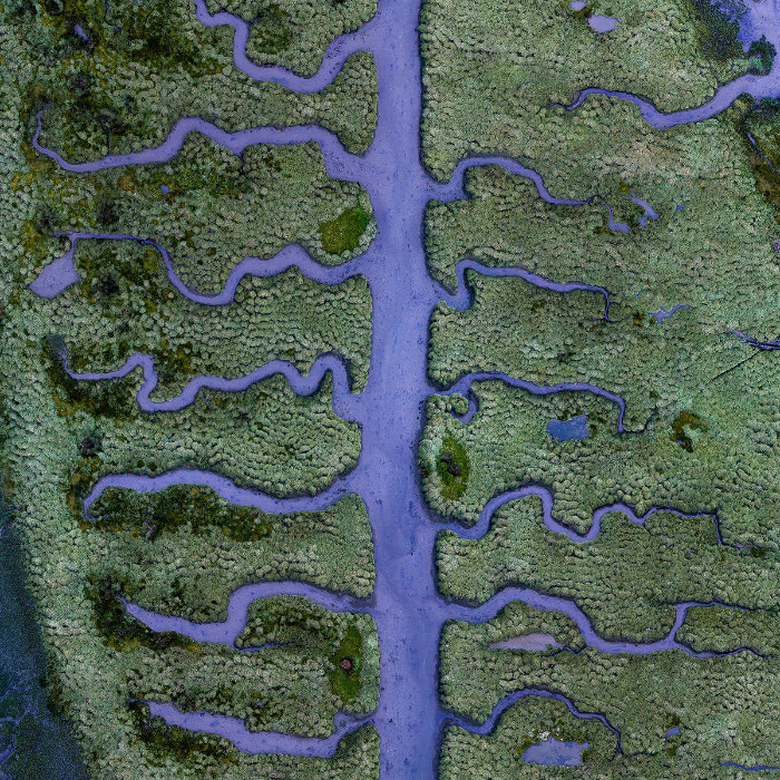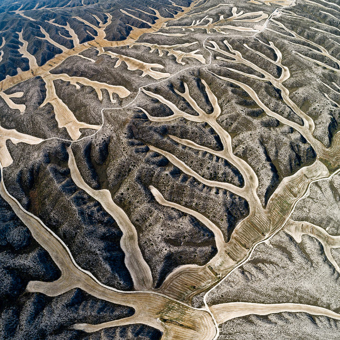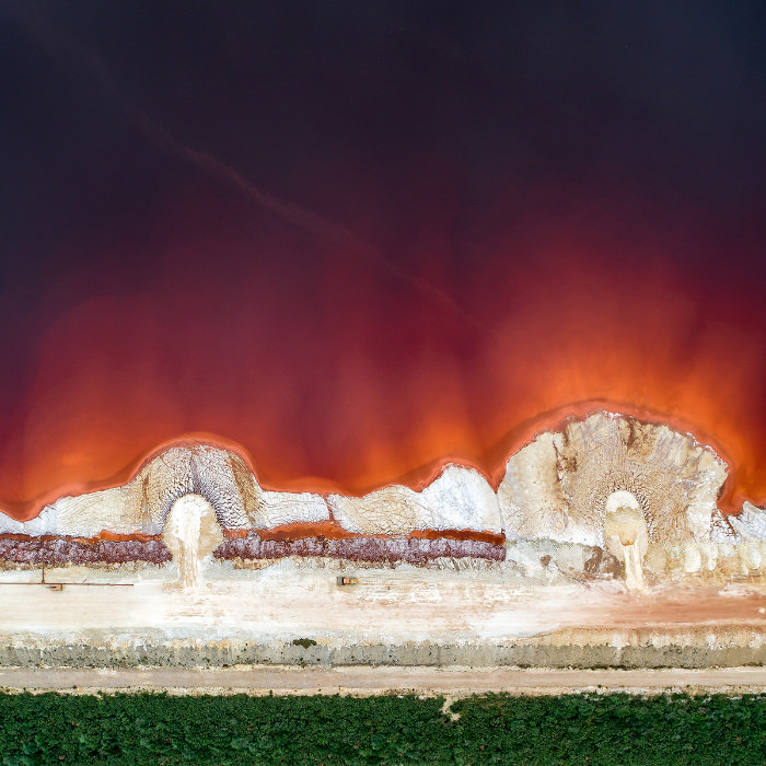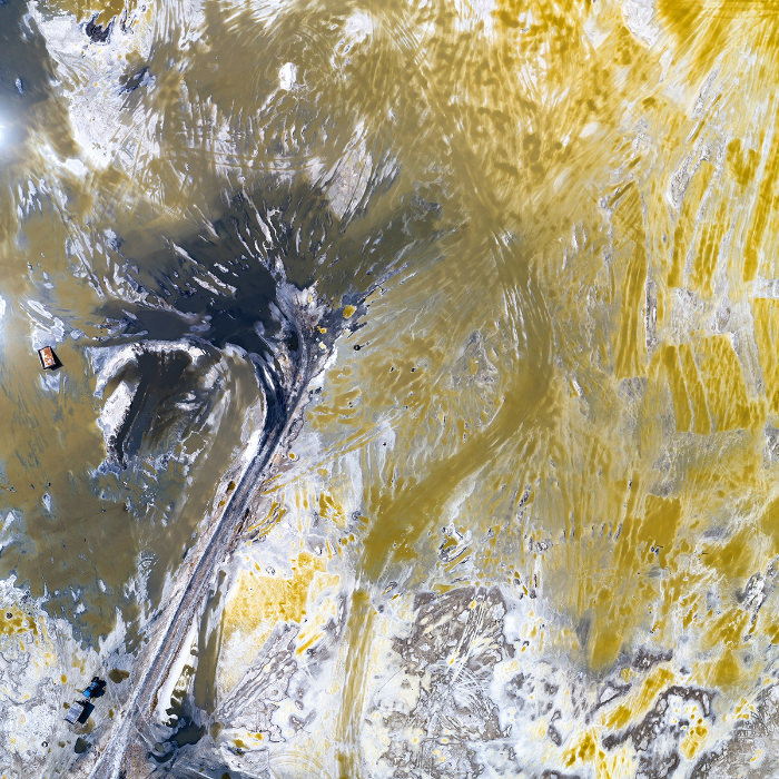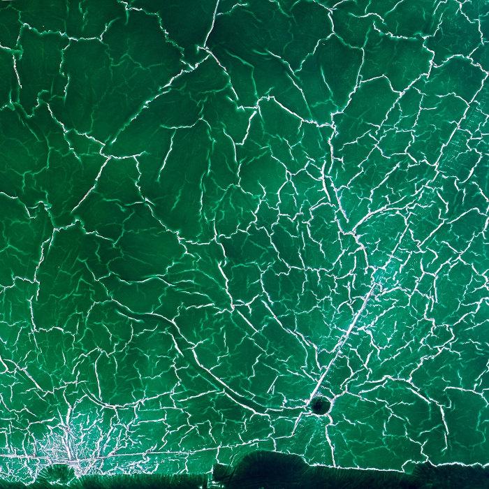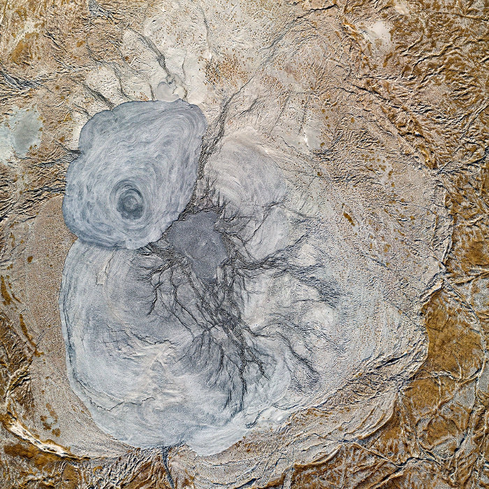
Conozca Water.Shapes.Earth. Los fundadores del sitio web creen que un punto de vista aéreo revela el verdadero carácter de los paisajes, a menudo desconocido para los que están en el suelo y los ven a nivel de los ojos. Como dicen en su página web, su "objetivo es abrir nuevas perspectivas mientras comparten historias, revelan lugares y cambian un poco las mentes". Les fascina cómo el agua da forma al planeta Tierra, creando patrones y colores abstractos. Aquí compartimos 10 fotografías del fundador y fotógrafo húngaro Milan Radisics.
Isla de los pantanos, Italia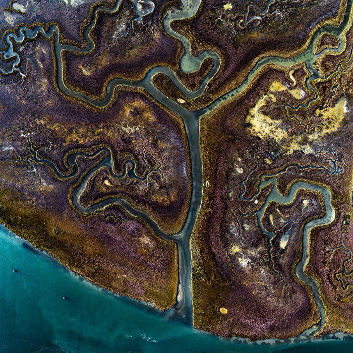 Fuente
El mayor humedal del Mediterráneo se encuentra en la Laguna de Venecia (Italia). Está compuesto principalmente por marismas. Gracias a las crecidas de las mareas, que aportan la cantidad justa de nutrientes, agua y oxígeno con cada marea, estas marismas se encuentran entre los ecosistemas más productivos del mundo. El resultado es la colorida hierba que puedes ver en la foto.
Marisma salada, España
Esta floreciente marisma cerca de La Coruña, España, está situada en el extremo de la ría de Betanzos. Hasta el siglo XVIII, el puerto de Betanzos fue un importante centro pesquero y comercial. Las singulares formas de éste fueron posiblemente influenciadas por los estanques de pesca hechos por el hombre que cubrían la zona hace siglos. Se supone que están influenciadas por una actividad realizada por el hombre porque sólo aparecen en una parte pequeña de la marisma.
Formas de arena, España

La Naturaleza Circular De Las Obras De Olafur Eliasson
Las formas circulares y esféricas se repiten en las obras de Eliasson, con la intención de reflejar un sentido de unidad y conciencia del entorno.

30 Hermosos Ríos Que Despertarán Tu Espíritu Viajero
El esplendor del agua en la forma de un río.

Los Secretos De La Naturaleza Capturados En 12 Fotografías
Conoce a los increíbles ganadores del Festival de fotografía científica de Beaker Street 2024.

¡El Violento Encuentro Entre El Fuego y El Agua!
Este compilado nos muestra las impactantes imágenes del momento en el que la lava se encuentra con el agua.
Los Patrones De La Naturaleza Forman Increíbles Obras De Arte
Este fotógrafo te llevará a descubrir la geometría detrás de los paisajes naturales.

5 Lugares Con Naturaleza Para Visitar En Nueva York
Para que tu próximo viaje a Nueva York sea lo más completo y emocionante posible, te recomendamos visitar los siguientes 10 sitios naturales.
 10:25
10:25
Come Un Pepino Al Día y Verás Lo Que Le Ocurre a Tu Cuerpo
¡Comer solo un pepino por día dará lugar a numerosos cambios positivos para la salud y beneficios de belleza!
 16:03
16:03
Dile Adiós a La Hinchazón y Los Gases Con Estos Ejercicios
En esta ocasión el experto en medicina alternativa japonesa Takashi Asaishi nos muestra los mejores ejercicios para aliviar la hinchazón abdominal y eliminar los molestos gases intestinales.
 4:08
4:08
¿Cuál Es La Función De La Coenzima Q10 En Nuestro Cuerpo?
La coenzima Q10 es una sustancia importante que aún es desconocida para bastantes personas. La coenzima Q10 es la encargada de llevar a cabo los procesos de respiración celular y obtención de energía en la célula.

Lo Que No Sabías de Tus Velas
Presta atención la próxima vez que compres o enciendas velas perfumadas. Pueden ser más perjudiciales para tu salud de lo que crees. Te damos tres razones.
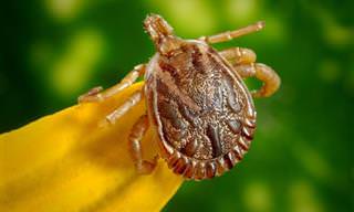
Las Garrapatas Son Pequeñas Cosas Horribles, ¿Verdad?
Las garrapatas son pequeñas cosas horribles, pero hay hechos clave que debes saber para protegerte mejor de ellas. Aquí hay 10 cosas que debes saber sobre las garrapatas.
 9:18
9:18
¿Cómo Ganar Masa Muscular Rápidamente?
¿Quieres saber cómo ganar masa muscular rápidamente? En este episodio Frank Suárez explica cuál es el mejor ejercicio para ganar masa muscular de forma rápida y saludable.

Trucos Sencillos para un Sueño Reparador
Cuando envejecemos es importante disfrutar de las horas adecuadas del sueño. Si quieres saber la razón y algunos trucos para dormir bien, haz clic en nuestra guía y descúbrelo.
 8:13
8:13
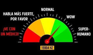
¿Qué Edad Tienen Tus Oídos? Descúbrelo Con Esta Prueba
A medida que envejecemos, podemos escuchar cada vez menos frecuencias de sonido. ¿Qué tan jóvenes son tus oídos? Haz esta prueba auditiva.

Nuevos Tratamientos Para Las Lesiones De Los Hombros
En este artículo vamos a analizar algunas de las técnicas innovadoras que los especialistas pueden utilizar hoy en día para tratar estas lesiones de hombro.
Descubre El Valor De Tu Tipo De Sangre
¿Sabías que tu tipo de sangre puede influir en tu salud y tal vez incluso en tu personalidad? Aquí tienes 20 datos sorprendentes sobre los tipos de sangre:

Por Estas Razones Deberías Comer Más Sandía a Diario
Una de mis frutas favoritas en esta temporada de verano es la deliciosa sandía, que además de ser dulce también es muy saludable. Hemos recopilado algunos artículos sobre los beneficios de la sandía así como unas rápidas recetas.
 6:43
6:43
La Clave Para Un Sueño Reparador: El Citrato De Magnesio
A continuación te explicamos a detalle cuál es la función del magnesio en el sueño así como la forma adecuada de tomarlo.
 7:55
7:55
Antidepresivos: Todo Lo Que Necesitas Saber
¿Cómo funcionan los antidepresivos? ¿Cómo tomarlos correctamente? Te damos una información súper útil acerca de la manera de tomar una de las medicaciones más habituales: los antidepresivos.

¿Tienes Más De 65? Este Ejercicio Fortalece Tus Músculos
Las últimas investigaciones muestran que los entrenamientos intencionales en escaleras pueden ser muy beneficiosos para las personas mayores.

Un Desayuno Con Alto Contenido De Omega 3 y Omega 6
Un desayuno de yogur es un gran desayuno saludable, rápido y sin esfuerzo. El yogur está naturalmente lleno de calcio, potasio, vitamina D, carbohidratos y proteínas.
 9:17
9:17
3 Signos En Tu Boca Que Son Indicio De Diabetes
Estas 3 señales podrían estar relacionadas con niveles de glucosa elevados en sangre.
 16:53
16:53
Técnica Japonesa Para Reducir El Estrés y La Preocupación
¡Prueba esta técnica de reflexología para experimentar múltiples beneficios para la salud!
 3:05
3:05
Beneficios Del Té de Manzana y Canela
Super saludable información sobre el té de manzana y la canela que por sí solos ya son maravillosos, Imagínate juntos en una delicioso té.
 16:52
16:52
7 Señales Que Pueden Indicar Que Tienes Prediabetes
La prediabetes como lo dice su nombre es un aviso previo de tu cuerpo de que podrías desarrollar una diabetes. Aproximadamente 1 de cada 3 personas son prediabéticas en los Estados Unidos y Latinoamérica.

7 Condiciones Médicas Extrañas Que No Creerás Que Existen
Estas extrañas enfermedades realmente existen.

12 Motivos Para Mantener Relaciones Íntimas Más a Menudo
El 'dolor de cabeza' no será nunca más una excusa... Te damos 12 razones por las que deberías tener relaciones de pareja de manera frecuente.

Evita Estas 16 Comidas Que Pueden Causar Hinchazón
Un estómago hinchado es solo una señal de que nuestros intestinos están luchando por digerir ciertos tipos de nutrientes en los alimentos.

Si Sientes La Boca Seca Es Mejor Que Conozcas Las Causas
En este artículo, nos enfocaremos en los síntomas, las causas y los tratamientos caseros de la boca seca para ayudarte a comprender y tratar la afección de manera más efectiva.

Hábitos Asiáticos Saludables Para Incorporar a Tu Vida
No es un secreto que en los países asiáticos cuentan con rutinas de salud y belleza tradicionales que han llevado a gran parte de la población a gozar de una esperanza de vida envidiable. A continuación te presentamos algunos de estos secretos.
 5:12
5:12
Abandona Estos 10 Hábitos Que Dañan Tus Riñones
Las enfermedades renales se refieren a menudo como "Las enfermedades silenciosas". Por esta razón debemos cuidarlos antes de que sea demasiado tarde. Aquí tienes una lista de los diez peores hábitos que debes abandonar para la salud de tus riñones.

Cuando La Fatiga Es Un Indicio De Algo Peor
Una sensación de cansancio leve que pasa al cabo de un tiempo es bastante común, pero resulta que si ataca con demasiada frecuencia o persiste durante mucho tiempo, puede predecir algunos peligros importantes.
 8:42
8:42
Limpieza suave del hígado con licuado
En este video te enseñamos como limpiar el hígado con productos naturales como el gengibre, la papaya, y la curcuma

Plantas que sanan cuerpo y mente
Los beneficios de las plantas medicinales se conocen desde la antigüedad, mucho antes de que la medicina moderna hiciera su aparición. Hoy hemos recopilado para ti nuestros mejores artículos sobre el uso de plantas medicinales.

La Canela Puede Hacer Mucho Más Por Ti De Lo Que Piensas
¿Sabías que la canela puede tener más beneficios aparte de los que ya conocemos? Te invitamos a leer un poco más al respecto en nuestra recopilación de 7 artículos.
 12:51
12:51
¿Quieres Aliviar La Hinchazón Abdominal? Prueba Esto
Esta especia cambia las reglas del juego en lo que respecta a la hinchazón y los gases.

Yogur Entero o Yogur Desnatado ¿Cuál Es Más Sano?
Durante décadas, se nos ha dicho que los lácteos enteros aumentan nuestro riesgo de enfermedad cardiovascular, pero ¿es cierto?

Cómo Hacer Frente Al Trastorno Afectivo Estacional
Cuando las horas de luz comienzan a disminuir y el clima se vuelve más frío, muchas personas suelen experimentar síntomas parecidos a la depresión. Te damos consejos para superar esta condición..
 7:17
7:17
Cómo Revertir La Diabetes - Consejos Médicos
¿Es posible vencer la diabetes? Vale la pena probar estos trucos...
 1:58
1:58
Piénsalo 2 Veces Antes De Creer Estos Mitos De Salud
¡Es hora de dejar de caer en estos falsos trucos de salud!

Cuida Tu Salud Mental Evitando Estos Ingredientes
Éstos son algunos de los peores tipos de alimentos que puedes comer si te preocupa tu salud cerebral.

7 Artículos Con Toda La Información Sobre La Depresión
La depresión, es sin duda la enfermedad de nuestra época, la que causa más discapacidad. Se ha escrito mucho sobre esta enfermedad. Hoy en esta recopilación de artículos de ayudamos a entender qué es realmente la depresión y sus signos ocultos.
 20:54
20:54
Médico Explica Sobre Los Mitos De Los Productos Herbalife
Un médico nos explica sobre los principales mitos de los productos de Herbalife, desde los beneficios sugeridos por sus vendedores, hasta las contraindicaciones que pueden tener efectos nocivos para la salud.

¿Tratando De Dejar La Carne? Prueba Estos Substitutos
Si estás pensando en dejar la carne, aquí están 5 substitutos vegetarianos para lograrlo.
 13:37
13:37
¿Estás En Riesgo De Un Problema Cerebral?
El accidente cerebrovascular (ACV) es la enfermedad neurológica más frecuente. Y en esta ocasión el Dr. Takashi nos muestra un ejercicio japonés de tan solo 20 segundos para conocer tu riesgo de accidente cerebrovascular.

La Relación Entre Los Suplementos Alimenticios y Las Canas
¿Los suplementos alimenticios pueden prevenir las canas o es un mito? La respuesta es un poco complicada y la analizamos en este artículo.

Aprende a Tratar Estos 10 Síntomas Comunes Del Embarazo
Durante el embarazo nos molestan aún más. Para hacer frente a cualquiera de estos desagradables fenómenos, hemos preparado el siguiente artículo para que puedas atravesar este período con menos dolor y problemas físicos.

La Especia Picante Que Encanta al Cuerpo
Mucho se ha escrito sobre el poder curativo de la pimienta de Cayena aunque muchas personas aún desconocen sus poderes curativos y sus beneficios para la salud. Conócelos:
 9:05
9:05
Adiós Dolor De Rodillas y Articulaciones
Dile adiós al dolor de rodillas y articulaciones. En este video revelo los mejores 5 alimentos pata quitar o eliminar el dolor articular en solo 1 día. ¡No te lo pierdas!
Rejuvenece Tus Pies Con Leche y Bicarbonato
Crea tu mismo una mezcla para rejunecer tus pies con leche y bicarbonato de soda.
 7:04
7:04
14 Puntos De Presión Para Eliminar Dolores De Tu Cuerpo
Hemos recopilado algunos puntos de presión conocidos que puedes utilizar en situaciones cotidianas. Estos 14 puntos de presión te ayudarán a eliminar los dolores fastidiosos.

8 Tesoros Naturales para Tu Bienestar Diario
Te presentamos una lista de las 8 especias y hierbas más saludables del planeta. Puede que conozcas la mayoría de ellas pero... ¡procura incluir algunas en tu dieta!

El Vínculo Entre Abuelos y Nietos Es Importante
Nunca había imaginado que el vínculo entre abuelos y nietos fuera tan valioso. Esta investigación sin duda me abrió los ojos ante la importancia de los abuelos en la vida de los niños.

Activa tu mente con estos 9 ejercicios
El objetivo de estos ejercicios es cambiar nuestra forma de pensar, obligarnos a actuar o pensar de nuevas maneras y exponernos a situaciones y sentimientos que hasta ahora no habíamos experimentando.

Limpia Tus Arterias Con Estos 10 Alimentos
Las enfermedades cardiovasculares están en aumento. Sin embargo, estos alimentos puede ser de gran ayuda para garantizar que no seas una de sus víctimas.

ADVERTENCIA: 8 Químicos Que Todo Hombre Debería Evitar
Actualmente los hombres tienen un 40 % menos conteo de esperma y un 25% menos de testosterona. ¿Por qué? Debido a los químicos presentes en cosas a las que nos exponemos diariamente. Mantente alejado de estos 8 peligros para la salud.
 3:36
3:36
Ejercicios sencillos para aliviar el dolor lumbar
Los mejores consejos y técnicas de prevención para tratar el pinzamiento lumbar y mejorar tu calidad de vida.
 11:46
11:46
Lo Que Ocurre Cuando Te Aplicas Cáscara De Plátano
En este video, aprenderás un montón de trucos con la cáscara de plátano, tan atractivos que nunca más querrás tirarla.
 5:34
5:34
Si Crees Que Puedes Desarrollar Alzheimer, Mira Este Video
El doctor Alejandro Espinosa, del Instituto para la Síntesis en Medicina de México, nos explica de manera muy cercana algunos descubrimientos sorprendentes sobre la enfermedad del Alzheimer

El Poder del Masaje de Pies para Aliviar la Cabeza
¿Sabías que masajeando diferentes áreas de tus pies puedes tratar diferentes tipos de dolores? Si sufres de constantes dolores de cabeza, no dejes de probar esta técnica que estamos seguros te ayudará.

Prepara Esta Sencilla Sopa Contra La Inflamación
Esta deliciosa sopa de tomate, cúrcuma y pimienta negra no sólo es una delicia para el paladar, sino también ayuda a combatir el cáncer y la inflamación. Aquí está la receta...

Evita Estas 6 Posturas al Sentarte
Si pasas la mayor parte de tu día sentado en alguna de estas posturas, presta atención porque pueden ser perjudiciales para tu salud. Te contamos también cómo poner remedio.
 6:23
6:23
Té Que Ayuda a Reducir la Hinchazón
¿Sientes con frecuencia que el estómago se inflama y que estás a punto de explotar? El té que te presentamos a continuación te ayudará a eliminar los gases, combatir la inflamación y mejorar la digestión.
 10:03
10:03
Come chía 2 semanas y mira el cambio
¡Estas semillas son necesarias para llevar un estilo de vida saludable! Pero ¿Qué ocurriría si comieras semillas de chía todos los días? ¡Averigüémoslo!
 10:08
10:08
Come Avena a Diario y Mira lo que Pasa
Las fantásticas propiedades de este cereal te ayudarán a sentirte y verte mejor, tanto por dentro como por fuera, ya que es rico en minerales y vitaminas.

¿Migrañas? Un Experto Nos Explica Sobre El Tema
Los dolores de cabeza son una de las quejas más comunes que los médicos escuchan en sus consultas. En este artículo un neurólogo especialista en migrañas revela las claves para su diagnóstico y tratamiento.

Las Pruebas Médicas Esenciales Después de Los 50
Ahora que has llegado a la "edad media", 50-60 años, asegúrate de que mantener una buena salud. Pregunta al doctor sobre estas pruebas médicas y hazte una revisión completa.
Dale Alivio a Tu Artritis Sin Medicinas
La artritis es una condición que produce inflamación en una o varias articulaciones. Esta enfermedad afecta a más de 350 millones de personas en todo el mundo. Si la padeces, aquí unos remedios naturales que pueden ayudarte.
 11:19
11:19
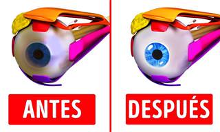
¡Estos Ejercicios Para Mejorar La Vista Son Fantásticos!
Ejercitar los ojos es una de esas cosas simples que muy pocas personas hacen, sin embargo puede ayudarte a mantener una visión saludable.

Tu Memoria y Los Efectos de Ciertos Medicamentos
Si te preocupa la memoria, estos medicamentos que ralentizan el cerebro pueden ser los culpables.
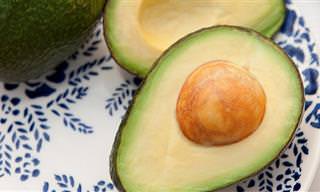
¡Nunca Imaginé Que Esta Fuera La Mejor Parte Del Aguacate!
¿Estás acostumbrado a rebanar un aguacate por la mitad y tirar la gran semilla que contiene? Después de leer este artículo, ¡estamos seguros de que dejarás de hacerlo!

Cabeza ligera gracias a tus pies
Prueba con la antigua técnica del masaje de pies y verás como el dolor desaparece en tan solo unos minutos.

Cómo Cuidar Tu Cerebro Cada Día
Tu cerebro es el órgano más importante del cuerpo, por lo que te avisamos sobre 10 hábitos que pueden dañarlo.
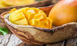
Los Beneficios Del Mango Para Tu Bienestar
A lo largo de la historia, cada parte del mango, incluida la fruta, la piel y las hojas, se ha utilizado como un remedio de salud de una forma u otra.

Casos en los Que el Ibuprofeno No Es Recomendable
Los deportistas y las mujeres adoran este medicamento, pero puede ser más peligroso de lo que piensas. Nunca tomes Ibuprofeno si sufres alguno de estos problemas médicos.

Reduce Tu Cintura Con El Método Japonés Usando Una Toalla
Tan solo necesitas una toalla. Esta sencilla técnica te ayudará a deshacerte de la grasa del abdomen y mejorar tu postura en 30 días.
 10:25
10:25
Come Un Pepino Al Día y Verás Lo Que Le Ocurre a Tu Cuerpo
¡Comer solo un pepino por día dará lugar a numerosos cambios positivos para la salud y beneficios de belleza!
 9:41
9:41
Te Contamos Los Los Beneficios De Beber Limón En Ayunas
En esta ocasión te presentamos algunos de los beneficios que pueden traer a nuestro cuerpo, el beber agua tibia con limón en ayunas.

Hora De Bendecir: "Gracias Señor Por Mi Fantástica Famila"
"Bendice Señor a mi familia"... Tener suficiente comida en la mesa todos los días, es una suerte, y tener una familia para cuidar definitivamente es una gran bendición. Da las gracias a Dios, con esta oración, por tu familia.

Alimentos Que Te Ayudan a Envejecer Mejor
Aún estamos lejos de descubrir la fuente de la eterna juventud, ¡pero estas comidas parecen ayudar mucho!
 5:12
5:12
Abandona Estos 10 Hábitos Que Dañan Tus Riñones
Las enfermedades renales se refieren a menudo como "Las enfermedades silenciosas". Por esta razón debemos cuidarlos antes de que sea demasiado tarde. Aquí tienes una lista de los diez peores hábitos que debes abandonar para la salud de tus riñones.


